Big Bend - Lost Mine Trail Photos
Return to Big Bend - Lost Mine Trail
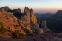
Sunset from Lost Mine trail (Photo by
oliverd)
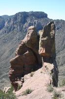
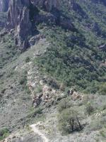
There are interesting rock formations along the trail. (Photo by
Blaze)
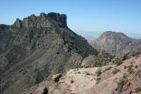
There are breathtaking views of the mountains and canyons below as you hike along the trail. (Photo by
Blaze)
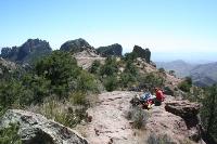
Some hikers relaxing at the top. (Photo by
Blaze)
One of the many scenic vistas from the trail. (Photo by
Blaze)

The kids were happy and energized to make it to the top! (Photo by
Gadget Girl)
We were almost up as high as them. (Photo by
Gadget Girl)
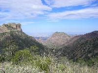
From the trailhead you can see where you'll be later in the day. Up there. (Photo by
Austin Explorer)
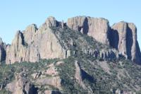
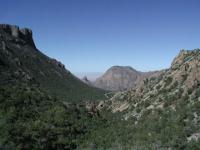
A view along the trail. Casa Grande is to the right. (Photo by
Austin Explorer)
-small.jpg)
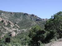
The earlier portions of the hike include dense coverage of Pinyon Pine and other trees. (Photo by
Austin Explorer)
The delicate balance of Big Bend's ecosystems is apparent along this ridge. The northern side is more lush. (Photo by
Austin Explorer)
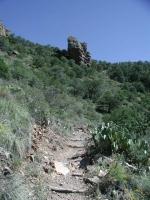
The switchbacks along the trail can be tiring. But concentrating on the rock outcropping ahead helps you keep focus. (Photo by
Austin Explorer)
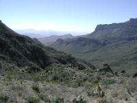
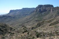
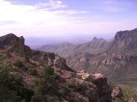
Looking down Juniper Canyon. The South Rim is in the distance slightly to the right. (Photo by
Austin Explorer)
Looking back towards the trailhead and the Chisos Basin further in the distance. (Photo by
Austin Explorer)
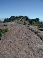
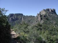
The last segment of the trail follows a largely bare ridge to the peak ahead. You're almost there! (Photo by
Austin Explorer)
-small.jpg)
We got an early start and watched the suns progress on the peaks. (Photo by
Eveline)
Picture taken from the peak. (Photo by
BigFrank3)
Picture from top of Lost Mine trail. (Photo by
BigFrank3)