Comanche Bluff Trail

Trail
7.50 Miles
650 Feet
N/A
3point5stars (3.55)48
2point5stars (2.80)
4stars (4.08)
N/A
Yes
Yes
No
Granger
Williamson
More Info

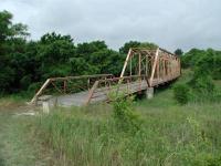
The Hoxie Bridge is one of the old Williamson County bridges salvaged from the scrap yard for the trail.
Getting there: From I-35 in central Round Rock take the Highway 79 exit and head east towards Taylor. Once in Taylor turn left onto Highway 95 and head north. Near the community of Circleville turn right onto FM 1331 and look for the park entrance on the left in about 4.5 miles.

The Hike: Granger Lake is one of the lesser known recreational areas around Austin. Situated in the rolling terrain of northeast Williamson County on the Blackland Prairie, it offers some interesting sites and good solitude away from the RV camping areas. An added bonus is that there is no charge for park admission for day hikers.
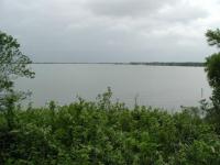
A view of Granger Lake from the trail.
The hike begins at the waypoint "Trailhead" at a parking area that includes a restroom. Printed trail maps are available here and at a couple of other stops along the trail.

The first section of the trail alternates between wooden sections and small pocket prairies. The trail skirts around a bluff on which RV camping takes place. In the first mile of the hike, the campers can occasionally be seen and are usually heard along the trail. One of the better views of Granger Lake can be found along this first section of trail, however.

The trail consists of a mix of wooded segments and open prairie.
The highlights of the first mile are the bridges. Granger Lake and the parks around it are administered by the U.S. Army Corps of Engineers. So one would expect them to know how to build a good bridge. Rather than settle on a small wooden span across two creeks they chose to over-engineer and save a little bit of history at the same time.
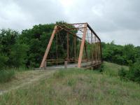
The Friendship Bridge.
The Hoxie Bridge can be found perhaps a quarter mile from the trailhead. It originally spanned the San Gabriel River, but was washed downstream in a flood in 1921. It was reconstructed and remained in use until 1979. Rather than send the outdated bridge to the scrap yard it was moved to Granger Lake in 1982.

The Friendship Bridge can be found at the waypoint of the same name about 1 mile into the hike. Like the Hoxie Bridge this one was destroyed by a flood in 1921, likely the same flood as the one that destroyed the Hoxie Bridge, and reconstructed. It too was moved to Granger Lake by the Corps of Engineers in 1982. These two bridges make for fine, if not overbearing, crossing of two of the trail's streams.

A few portions of the trail are a little challenging.  Here I had to crouch to get under the brush in a creek bed.
A few portions of the trail are a little challenging. Here I had to crouch to get under the brush in a creek bed.
The relatively flat, rolling terrain of the area surrounding Granger Lake is somewhat misleading. The lake's south shore hugs a modest ridge by hillcountry standards, but it provides a bit more of a challenge than the drive in would indicate. This becomes particularly evident as the trail proceeds west from an alternative trailhead at the waypoint "Alt TH". Not only does the vegetation close in on the trail, but the going gets tougher as the path descends into small, but steep, creek beds. On a few occasions I was not entirely certain if I was still on the approved trail and not some maverick trail.

Not all of the bridges on the trail are historic or overkill.
Following the ups and downs of the creek crossings, the trail flattens out a bit, but a new obstacle presents itself in the form of cow patties, and lots of them. It's like tip-toeing through a minefield, though without the danger. Still, by all means, watch your step.

Just when the worst seemed over, a more daunting challenge emerges. High water at some time in the past deposited a large amount of driftwood near the lake shore, smack dab in the middle of trail. When I say a large amount, I don't mean a few hundred limbs scattered about, perhaps in a contour line marking the old water line. No, I mean thousands of branches and trunks that litter the ground like poorly constructed wooden planking. There is no stepping around them, there is only walking on them, and trying very hard not to twist an ankle in the process. One might think about turning back, but that would be a mistake.

This carpet of driftwood provides an obstacle along the trail.
Things change dramatically at the waypoint "Gate". A fence has kept the cows out and so the cow patties almost disappear. A gentle glen of trees marks one of the quietest spots I found along the hike. A short distance to the west the tree cover recedes and some open prairie leads to a small inlet of the lake marked by the waypoint "Lagoon". Where I found two boys fishing who seemed to think it odd that I had walked about 3 miles at that point, with more to follow.

After the trials and tribulations, a serene segment in a glade.
The trail west of the lagoon occasionally splits off from the jeep trail into which it transforms. However, it may be a good idea to stick to the jeep trail, particularly when poison ivy is out. While the trail was mowed to keep the weeds at bay, the trail surface showed how prevalent poison ivy is in the part of the trail. Walking on poison ivy stems is as bad as brushing against them if you happen to touch the soles of your shoe for some reason.
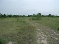
One of the larger pocket prairie segments along the trail.
The end of my hike is marked by the waypoint "Turnaround". However, it may not be the end of the trail, depending upon your view. The jeep trail continues to south from the turnaround point, but from this point it appears to be a service road for the primitive camping area that can be found here. There was not another soul in sight as I stopped in this well maintained camping area to have a snack and drink of water. The facilities include tent sites, picnic tables and a chemical toilet.

As I sat on a dead log right along the San Gabriel River just before it feeds into the lake, I noticed some ants hard at work. Three large ants were busy excavating a depression in the log, making a home for themselves. Two of the ants would pick up bits of wood and crawl to the end of the log and drop the chip off the side. The third ant below picked up chips from the pile and moved them farther away from the log. On and on they went, in tireless toil. Who am I to complain about driftwood and cow patties on the trail?

Doubling back to the trailhead I ended up hiking 7.5 miles, quite a bit more than I was expecting, but well worth it. On the way back I used the alternate southern loop marked on the map in blue around the southern edge of the RV camping area. I would generally not recommend this route since it cuts right through a busy section of the camping area complete with lots of people, vehicles, boom boxes and the like.

Photos
along the southern half
one can get lost along this southern section (Photo by jimmy peace)
other truss bridge
the other one (Photo by jimmy peace)
truss bridge
one of the truss bridges on the trail (Photo by jimmy peace)
Where we gave up
We couldn't find a trail around the inlet marked "Slough of Despond." We followed a jeep track for a while, but some hunters were really letting the local wildlife have it, so we turned around. (Photo by plectrudis)
Cactus and possumhaw
An especially nice color combination--prickly pear and the orange-berried possumhaw. Most of the trail was shadier, rockier, and less flat. (Photo by plectrudis)
Bridge & Nice Little Swamp
Trail has two old iron bridges and loads of small footbridges. This was one, crossing a small creek + mini swamp. (Photo by plectrudis)
Friendship Bridge
Crossing Friendship Bridge (Photo by Eveline)
Trail is almost invisible in places
Tall grasses obscure the trail in places. (Photo by crocodile235)
San Gabriel River at Fox Bottom primitive campground
This river access point is easier to use to climb out of the river after swimming. The other river access area is pretty steep. (Photo by crocodile235)
Lake View
A view of the lake along the trail before plunging into the woods again. (Photo by Austin Explorer)
Jeep Trail
A few segments of the western end of the hike follows a jeep trail. (Photo by Austin Explorer)
San Gabriel River
The San Gabriel River before it empties into the lake. The primitive camping area here was deserted. (Photo by Austin Explorer)

Only showing last 12 photos. View All Photos

Log Entries
By JJohnjacobsen on 2/13/2018
Rating: 3stars Difficulty: 3stars Solitude: 4stars
Distance: 5.00 Miles Duration: N/A
confusing
By jimmy peace on 8/20/2016
Rating: 2stars Difficulty: 1point5stars Solitude: 4point5stars
Distance: 3.20 Miles Duration: N/A

this trail becomes confusing.. it seems to disappear, ... on the southern half

did the upper part
By jimmy peace on 8/7/2016
Rating: 3stars Difficulty: 2point5stars Solitude: 4point5stars
Distance: 2.80 Miles Duration: N/A

it was a hot hike,  next trip i do the lower hike , lots of poison ivy tho

Pretty bridges, interesting wildlife, but problematic after a rain
By plectrudis on 1/18/2016
Rating: 3stars Difficulty: 3point5stars Solitude: 3point5stars
Distance: 9.50 Miles Duration: N/A

This was a nice, long trail with some pretty, forested bits, but we went astray right after crossing the Hoxie Bridge (take an IMMEDIATE right, even though the trail also continues straight ahead).  Also, lots of little temporary springs had sprung to life, so parts of the trail were a muddy mess.

On the plus side, there is a good bit of shade, the many bridges that cross little runnels and ravines are neat, and there are mile markers every1/10 mile (starting after the Hoxie Bridge :-(  ).  The park staff were very helpful--as they had no maps on hand, they drove out from the main office 15 min away to bring us some.

But the biggest drawback was at marker ~2.7--a big slough kind of thing crosses the path, and we couldn't find a way around it. You can follow what looks like a utility right-of-way up to a Jeep track, so we did that for a while, but it never rejoined the trail proper, and there was a lot of shooting going on (from hunting, not drug deals gone wrong), so we gave up and turned around.  This area was also thick with litter washed in with the rains, unlike the rest of the trail, which was quite clean.

Even so, it made for a good, long hike (especially with our wrong turn after the HB), and all the up-and-downing through the ravines gave us quite the workout.  Also, we saw 10 white-tailed deer, and a big black boar went crashing through the forest about 40 feet in front of us.  Much excitement.

Enjoyable
By Eveline on 11/7/2015
Rating: 4point5stars Difficulty: 3stars Solitude: 4point5stars
Distance: 2.00 Miles Duration: N/A

We started at the free trailhead on FM 496 and walked northeast over the Friendship bridge, past the juncton with campsite #45 and on for quite a way.  I estimate that our out and back was 2 miles.

solitude!
By crocodile235 on 5/2/2015
Rating: 4stars Difficulty: 2stars Solitude: 5stars
Distance: 6.00 Miles Duration: N/A

My dog and I started at the alternate trailhead and took the trail 3 miles to the Fox Bottom Primitive Campground.  The trail winds in and out of small wooded areas, but spends much of its time in meadows with tall grasses and wildflowers.  In places the trail was almost entirely obscured by grass, but common sense plus occasional trail markers made it impossible to get lost.  I did not see any cow patties or snakes.  The driftwood has been cleared off the trail.  I did see a fair amount of poison ivy, but it was *mostly* outside the trail zone.  Although it was a gorgeous day, we only saw one person on the trail.

We spent the night at the campground in blissful solitude - no one else around other than a few folks going by in small boats.  The campground was quite overgrown and had poison ivy around its edges.  The chemical toilet was full of trash and unusable.  There are two short trails from the campsite that provide access to the San Gabriel River, but one of them has a deep drop-off such that it is pretty much impossible to climb back out of the water after you swim.  My dog jumped in and couldn't get out - I jumped in, gave him a hefty shove onto the bank, then realized that I couldn't get out either!  Ha.  Luckily the other river access location is quite a bit easier to climb out of.  That one is still a fairly good drop-off, though, which makes filtering water a bit of a balancing and stretching exercise. 

Only person in the park
By Sunshinedog on 11/8/2014
Rating: 4stars Difficulty: 2point5stars Solitude: 5stars
Distance: 3.50 Miles Duration: N/A

this is not a difficult hike and it is quite lovely with the bridges.  Except the first bridge was closed, they are replacing all the slats.  Did not hike the entire trail- got a late start.  But will be back in a few weeks to hike the entire trail.

By Jessica.Preston on 12/15/2013
Rating: 3stars Difficulty: 2point5stars Solitude: 4stars
Distance: 3.20 Miles Duration: N/A
West end not as nice
By texaskdog on 3/6/2011
Rating: 2stars Difficulty: 2stars Solitude: 4point5stars
Distance: 5.00 Miles Duration: 1 hour, 45 minutes

We took the eastern part before, so this time we hiked form the Hwy 496 entrance to the west.  The western part is not well labeled as we hit a fork, to the right ended in the lake, to the left hit a jeep trail which we followed.  According to this map somehow we would go down the middle.  Eventually we saw some pink ribbons and turned off the jeep trails but that seemed to end too.  According to the map here that was the right way.  Eastern half is definitely the nicer half of the trail, but you can hike west til the 2nd crossing, about 15 minutes west of the hwy 496 entrance.  Good luck finding the scout camp.

Hiked from Alternate TH to Primitive Camp
By rrtex1 on 2/12/2011
Rating: 3point5stars Difficulty: 2stars Solitude: 2stars
Distance: 5.50 Miles Duration: N/A
Family started at Alt. TH and headed west on trail from parking lot. Trail is well marked and well groomed. About .75 miles down trail came across a brush fire that was being put out. Trail is great but becomes littered with debris from last years flood. After we got to the ponds on the road portion of the trail we lost the trail completely due to flood debris and overgrowth and just followed river until we found camp. Camp is very nice with big trees and nice open grass. We will go here to camp in the future. When we left we followed the road all the way out which was not as scenic but was a bit shorter than following the trail. Saw lots of hawks, cardinals and other birds. Had a good time.

Only showing last 10 log entries. View All Log Entries

Recommended Item
Recommended Item Lone Star Travel Guide to the Texas Hill Country
Richard Zelade
List Price: $18.95 Your price: $18.95 Buy Now
This book brings the remarkable Hill Country of Texas home to the back roads traveler. Whether it’s wildflowers you’re drawn to, or dude ranches, natural areas, historic sites, or quaint Texas towns redolent of history, this is your passport to an experience like no other. Backroads of the Texas Hill Country introduces travelers and armchair tourists alike to the emerging wine country of the Lone Star State, the meticulously preserved culture of East European immigrants, the “cowboy capital of the world” (Bandera), and the childhood home of LBJ at Johnson City. Follow this irresistible guide into the Hill Country, and find yourself deep in the heart of Texas.