[ Log In ] or [ Register ]
Texas Hiking

Blunn Creek Preserve

Trail (3.17)
(1.80) (2.90)
1.50 Miles 320 Feet
N/A
No No
Free More Info
Austin Travis
Take Action Bookmark and Share

Getting there: From Central Austin on I-35, take the Oltorf Street exit and head west on St. Edwards Drive. Look for the preserve on the right side soon after a bend in the road after St. Edwards Circle.

The Hike: Just blocks away from nearby Blunn Creek Greenbelt, Blunn Creek Preserve feels like another world altogether. The park is larger, more rugged, less visited and offers a bit more of a true hiking experience, all the while still surrounded by South Austin.

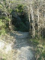
The trail surface is mostly compacted dirt and gravel, typically in good shape.
We began our hike at the western preserve entrance marked by the waypoint "Trailhead". Please note that the start of our hike turned out to not be the official entry point to the preserve. When visiting, please enter the preserve from the south, along St. Edwards Drive. There are much better parking options at the south entrance.

If you've hiked the nearby greenbelt, the first thing that you'll notice is that this is no city park. It's run as a nature preserve and so remains largely wild and rough. The trails, though well maintained, are rocky and occassionally steep. One moment you'll find yourself enveloped in dense tree cover and the next you're looking out to sweeping vistas of the preserve and surrounding city from atop a hill.

We started to the left and headed north in the direction of the waypoint "Overlook", near the eastern edge of the preserve. This first overlook is the more impressive to be found along the trail and look upon St. Edwards University, also on a hilltop in the area. Another overlook a short distance to the north provides views into parts of downtown Austin.

Several overlooks provide views of downtown and other parts of the city.
At points on the trail a close examination of the trail surface will uncover something a bit odd about the gravel's texture. The odd mixture is actually compressed volcanic ash, the by-product of eruptions from Travis County's very own volcanoes that existed here approximately 75 million years ago. Some of the tops of those volcanoes now provide birds' eye views of the surrounding terrain.

Though hilly in places the trail tends to be well maintained.
In the more recent past, part of the land that makes up Blunn Creek Preserve used to be a dairy farm in the 40's and 50's. The city acquired the land and set it aside as a preserve, but not before significant damage had been done to native flora and fauna that live here. On our trip we just happened to run into Rene Barrera from the City of Austin's Parks and Recreation Department. We'd met Rene before and on this occassion we touched on some of the changes that this land has witnessed in the last 100 years. Foreign, introduced plants are choking out the natives that many of the local animals depend on. Here, Chinaberry and Lugustrum are the two main culprits, though they are not alone. With its meager resources, the Parks department does what it can to hold back the invasive species to try and give the natives a chance to fight back.

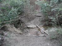
Most creek crossings were trivial. But this one presented a bit more of a challenge.
As we continued our hike we stopped by the third overlook along the trail at the waypoint, "Overlook3". Here the creek canyon walls are steeper than in other areas of the preserve and this overlook provides a vantage point from which to observe from above the vegetation that runs along the creek's banks.

Some sections of the trail can be a bit steep.
The southern half of the preserve is less hilly than the northern portion. Mostly, the trail parallels the creek and crosses it at one spot marked on the map. The southern crossing is the more difficult of the two by a longshot though and this crossing may not be an option following heavy rains.

The highlight of the trail in the southern section is the group of springs marked by the waypoint of the same name. There are two here in close proximity. Though the preserve boasts several others and some additional springs flow nearby outside of the preserve boundaries, these springs are the closest to the trail.

The length of the hike at the preserve is a short 1.5 miles. However, what the preserve lacks in mileage it more than makes up for in roughness and beauty. One should not expect to avoid other hikers on the trail, but the number of people encountered here is far less than one would see at the Blunn Creek Greenbelt hike just a couple of blocks away. So if you find yourself in South Austin with a need for a quick, escape from the hustle of city life reserve some time to try out this preserve.


Photos

If you enter from Longbow head north and this tree is just across the creek. Keep going Northeast to get to the Volcanic overlook. (Photo by Caledonia) (Photo by Caledonia) View from scenic overlook One of the high points on the hike is the top of this ridge that overlooks St. Edwards and downtown Austin. (Photo by swedegirl5)

Log Entries

Cute little trail
User: claireific - 7/17/2010  [View Log Page]
Rating: Difficulty: Solitude:
Distance: 2.00 Miles Duration: N/A

As hikes in Austin go, this one gets points for solitude (I didn't see anyone else the entire time) and scenery. The high point has a great view of St. Edward's and downtown, and there are plenty of trailmarkers, which I happen to prefer. It wasn't particularly special or challenging, and I like the hikes further southwest better (Barton and the like) but this one was nice. There's a little creek, and as one reviewer noted, a fair amount of debris and litter. It's too bad, really. Bonus: I saw a bright purple dragonfly and a cottontail rabbit on the trail!

Canyons, rivers and volcanos in the middle of town.
User: swedegirl5 - 2/23/2010  [View Log Page]
Rating: Difficulty: Solitude:
Distance: 1.20 Miles Duration: N/A

Nice little hike with several amazing views and interesting history lesson about the geology of the region.

Very disappointing
User: sdonaldson - 2/20/2010  [View Log Page]
Rating: Difficulty: Solitude:
Distance: 1.50 Miles Duration: N/A

There was considerable trash just about everywhere especially along the creek.  Basically a dump.  There was no one around and I understand why.

Awesome view, secluded, my new favorite hike
User: smeevil - 4/12/2008  [View Log Page]
Rating: Difficulty: Solitude:
Distance: 1.50 Miles Duration: 1 hour

This trail is actually marked, which is unusual fo Austin trails.  Like the others have said, it is surprisingly quiet.  I like to take "night hikes," and I'd say this trail is perfect for that.  Awesome view with the "volcanic overlook." 

Surprising oasis.
User: Caledonia - 4/10/2005  [View Log Page]
Rating: Difficulty: Solitude:
Distance: 1.50 Miles Duration: N/A
I never knew this gem was here. The bluebonnets are in bloom which made this hike even more beautiful. The kids love it and call it Jurrasic Park because of the Volcano intrigue. The huge Oak tree on the west side of the preserve is also a must see.
User: budrow - 9/28/2004  [View Log Page]
Rating: N/A Difficulty: Solitude:
Distance: 1.50 Miles Duration: N/A
Very nice preserve
User: figment - 11/2/2003  [View Log Page]
Rating: N/A Difficulty: Solitude:
Distance: 1.50 Miles Duration: N/A
Even though you are very close to I-35, you'll feel like you are out in the woods. The view of St. Edward's University's main building from the Volcanic overlook is great - St. Ed's is built on top of a volcano, one of 12 that used to be in Travis County. The creek is pleasant, although I didn't see any springs, there are several of them in the park. I parked on St. Edward's Drive in front of the park - there are two trail entrances on St. Edward's Drive, 200 feet from eachother on opposite sides of Blunn Creek.
A Beautiful hike
User: theflea - 7/23/2003  [View Log Page]
Rating: N/A Difficulty: Solitude:
Distance: 1.50 Miles Duration: N/A
This hike to me was pretty easy.I thought the hike was cool. Along the way I saw a rabbit. You will cross two creeks. You have to jump across the second creek. The first creek you just have to walk across, big rocks in the creek. The second you should be careful. I jumped across the creek and at the other side I slipped. It looked dry, but it was slippery. A little later you come to a fork in the road. The sign says v.OVERLOOK FOR VOLCANIC OVERLOOK to the right. Oltorf to the left. I went to the volcanic overlook. You can tell you are very close by red ash on the ground. When you get to the overlook, you have a great view. You can see the trees below you. You have a good view of St. Edwards. Then when I was back at my house I said, what a beautiful hike.
78704, it's more than Barton Creek.
User: oceanus - 7/20/2003  [View Log Page]
Rating: N/A Difficulty: Solitude:
Distance: 1.50 Miles Duration: N/A
Blunn Creek Preserve is an enjoyable hike in the heart of South Austin. Less used than its 78704 neighbor, Blunn Creek offers a quick get away for people living south of the river. Plus, because it is less known than Barton Creek, hiking the trails can be more relaxing; you won't find bikers zooming by every two seconds. The trails are very well marked, except for a few in the northern part of the preserve, which allows for easy hiking. The Volcanic Overlook is the best view in the preserve. Suprisingly, the view from the overlook is not congested with houses and other structures; there is a great view of St. Edwards Univeristy, which sits on an extinct volcano, plus you get an excellent view of the hills to the west. When hiking in from the south, you'll see red volcanic ash on the trail, just before you reach the overlook. Check it out while you can because it has diminshed significantly in the last few years. The vegetation in the preserve is largely regrowth, but that's o.k., considering the ever growing IH-35 is less than a half of a mile away; but don't fear, while hiking in the preserve you'd almost never know it.
A little distance means a lot
User: Austin Explorer - 1/4/2003  [View Log Page]
Rating: Difficulty: Solitude:
Distance: 1.50 Miles Duration: N/A
We hiked Blunn Creek Greenbelt and Blunn Creek Preserve on the same day. Just a few blocks apart, the two trails could hardly be more different. The greenbelt is flat, open and populated. The preserve is rugged and more solitary (though by no means deserted). Parking can be a pain, but the trails provide at least a little real hiking, as opposed to walking.

Recommended Item

Recommended Item Austin (Austin (Lone Star Guides))
by Richard Zelade
List Price: $15.95 Our price: $2.00 Buy Now
Here is the best, most comprehensive guide to Texas's capital city. More than just a travel guide, this book takes you on a journey through the past and present of this intriguing city.