San Angelo State Park Photos
Return to San Angelo State Park
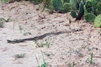
This guy was 5-6 feet long! He did not mind me taking his picture. I left him and when I returned a few hours later, he was gone. (Photo by
MikeHikes)
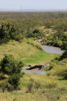
The rock you see is normally covered when the water flows in the river - easy to see what the drought has done to the area. We need rain and lots of it! (Photo by
MikeHikes)
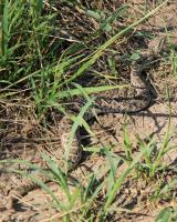
Found on East Potts Creek Trail. I saw him from about three feet away, I backed up and had tossed a few sticks to get him to move off the edge of the trail. He went into the brush and rattled his warning as I gave him a wide berth. (Photo by
MikeHikes)
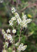
Hiking throughout the park, the wind carried the strong scent of vanilla from this plant. The plants are throughout the park and made the hike very enjoyable. (Photo by
MikeHikes)
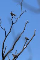
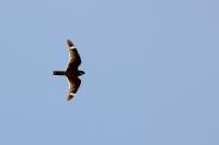
An adult Kite is bracketed by two juvenile Mississippi Kites. saw lots of other birds as well today. (Photo by
MikeHikes)
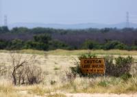
Although we've had some rain lately, this sign is from L-O-N-G ago. Maps show O.C. Fisher Reservoir as being a fairly large lake - it is currently at 1% capacity and all the water is at the southern end by the dam. UPDATE 09-16-20 Water level is 7.2% (Photo by
MikeHikes)
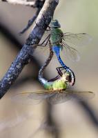
Working on the next generation of dragonflies! (Photo by
MikeHikes)
This hawk made a swoop and miss at the adult duck who got her ducklings under the tree. After awhile, the hawk left and the ducks continued their lives undisturbed. (Photo by
MikeHikes)

This guy was fascinated by his reflection in my camera lens. Once his curiosity was satisfied, he climbed back down and scampered off. (Photo by
MikeHikes)
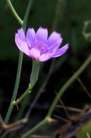
Flowers continue to blossom at the park! The majority are these purple flowers as well as some large sunflowers located near the streams and ponds. (Photo by
MikeHikes)
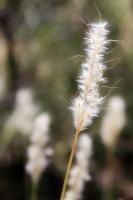
Saw quite a few weeds with their seeds waiting to be taken by the wind or when touched by humans or animals. (Photo by
MikeHikes)
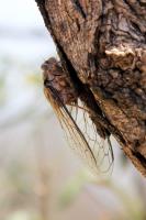
I've seen a few of these abnormal cicadas missing the entire lower body yet it's very much alive - or is it merely a re-animated husk ready to devour any living cicadas it encounters? Perhaps this is the dawn of the long dreaded Zombie Apocalypse!! (Photo by
MikeHikes)
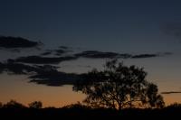
A photo I shot while at the park. (Photo by
MikeHikes)
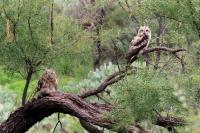
Was very surprised to see these two owls at 11am! They were about 20 yards or so off the trail and content to observe us as we stopped to take their picture. Always a treat to see the many types of birds at the park! (Photo by
MikeHikes)
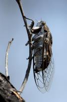
There are a lot of cicadas still out and about. I can't count the number of times I would startle one of these guys and they would fly away with a loud buzzing sound. A couple of times, I was whacked on the head as they flew into my hat! (Photo by
MikeHikes)
this guy is always looking for a meal - don't be his next one! Drink plenty of fluids, watch where you step and stay safe while hiking. (Photo by
MikeHikes)
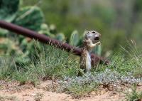
Saw this female Mexican Ground Squirrel eating what I think is a nut near Cougar Outlook. Don't see too many of these squirrels on the trails. (Photo by
MikeHikes)
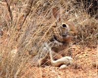
This guy was watching me as I approached. When he was first spotted in this photo, he was standing up, however, the closer I approached, the lower he went. By the time I reached him, he was flat on the ground. (Photo by
MikeHikes)
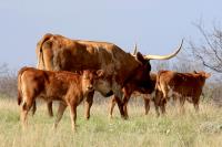
As cute as they are, these calves are not pets! Calves are with their mothers who can be very protective. Stay safe, take a picture from a distance and leave them alone! (Photo by
MikeHikes)
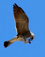
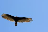
This Mississippi Kite and his/her numerous companions were out in force today. I was able to capture a few shots of this one chowing down on what looks like a cicada, while flying. (Photo by
MikeHikes)
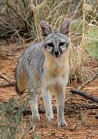
This fox was hunting for a minute or so and didn't notice me at all. When he saw me and walked closer to investigate, he finally caught my scent and disappeared within a second or two. He was seen around noon on an overcast, windy day. (Photo by
MikeHikes)
It's easy to see how these guys blend into their environment. He watched me but didn't take off until after I snapped the shot. (Photo by
MikeHikes)
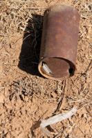
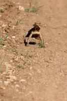
As can be seen, this old can served a useful purpose to a small snake. The snake used the sharp edge of one hole so it could shed it's old skin. No bones found in the can so the snake was able to slither out successfully. (Photo by
MikeHikes)
Although the word "Night" is part of the Common Nighthawks' name, they can be found swooping through the air catching insects during the day - beautiful birds! (Photo by
MikeHikes)
 BackNext