Buffalo Bayou To The Second Ward
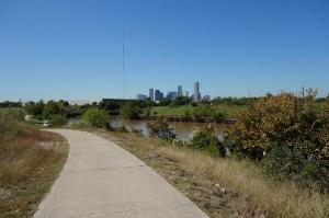
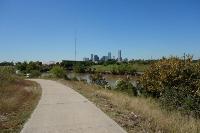
View Of The Trail
The trail runs along the south bank of Buffalo Bayou and gives you a nice view of downtown Houston.
User: Blaze - 10/24/2013

Location: Buffalo Bayou Trail

Rating: 1point5stars
Difficulty: 1star  Solitude: 1star
Miles Hiked: 12.30 Miles  Elapsed Time: 3 hours, 55 minutes

Comments:

Today, I hiked the part of the Buffalo Bayou Hike & Bike Trail that I was unable to complete on my previous hike (October 15, 2013).  Specifically, I hiked the section on the south side of Buffalo Bayou in northeast downtown.  I also hiked Tony Marron Park as well as the Harrisburg and Sunset Rail Trails and Hidalgo Park.  Rather than loop back and move my car from place to place, I thought it was easier to simply hike from one trail to another through the streets of Houston.

Since this was a varied hike, I will discuss each section separately.

I parked my car and started my hike at Tony Marron Park.  The park had a playground and some open, grassy areas, but overall the park was rather dirty.

I then hiked out of Tony Marron Park on the Buffalo Bayou Hike & Bike Trail heading west towards downtown Houston.  The trail was paved cement in some places and dirt trail in others.  Some parts of the trail were poorly maintained and overgrown and it did not take you through a very nice or safe part of town.  Just past the railroad tracks beyond Jensen Drive, the trail ended abruptly and you could not go any further due to a fence.  This is noteworthy because on my October 15th hike, I had to turn around while crossing an old, out of service train bridge that crossed Buffalo Bayou.  I was disappointed because I thought that if I could have gotten all the way across, I would have been able to hike along the south bank of Buffalo Bayou to Tony Marron Park, which was my original hike plan on October 15th.  Today, I learned this was not possible.  From what I can learned, the Buffalo Bayou Hike & Bike Trail is not a single continuous trail, but rather two disjointed sections -- one that is mostly on the north side of the Buffalo Bayou (i.e., the part I hiked on October 15th) and another segment on the south side of the Buffalo Bayou (i.e., the part I hiked today).  If this isn't clear, please look closely at my two .GPX track files to see where these segments run.

Back to today's hike - after I was forced to turn around, I hike back to Tony Marron Park and then kept going east along Buffalo Bayou to Lockwood Dr.  Along the way, I got a view of the inner bowels of the city's junk metal scrap yards.  Noisy, ugly, smelly, industrial...

At Lockwood Dr., the trail ended so I turned right and started walking through the streets of the Second Ward to pick up the Harrisburg Rail Trail.  This is intended to primarily be a bike trail, but it will be useful to pedestrians (hikers and joggers), too.  However, it should be noted that this trail is currently under development.  They were still pouring the concrete when I hiked it.  I should also point out that the map shown on the "View Alternate Map" link shows the trail veering onto Harrisburg Blvd, but I think this is the way they want you to go right now while the real trail is being developed.  If you look at my track file, you will see that the trail runs between some housing developments and runs parallel to Harrisburg Blvd.

When the Harrisburg Rail Trail ended, I then walked further through the Second Ward to pick up the Sunset Rail Trail.  This trail is finished and runs adjacent to the railroad tracks all the way to Hidalgo Park.

When I arrived at Hidalgo Park, I walked around and through the park.  I should mention that the Second Ward is primarily Hispanic and at times I felt like I was walking through a Mexican border town.  All the businesses were Hispanic and I found that Hidalgo Park commemorates the founder of Mexico.  I welcome and appreciate diversity, but I'm not sure why the park commemorates a foreign hero rather than a domestic one.

Anyways, on my way back, I decided to take Navigation Blvd back as a short cut since I did not see any benefit to hiking back the same way as there was not much to see.  I just want to make that clear to anyone reading this log because my track file consists partly of trails joined together with some urban walking.


Log Photos
View Of The Trail
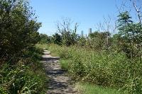
Another View Of The Trail
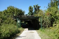
End Of The Trail

The Other End Of The Trail

Scrap Metal Recycling
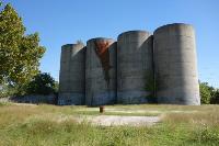
Some Spots Are A Little Run-Down
Recommended Item
Recommended Item 60 Hikes Within 60 Miles: Houston: Includes Huntsville, Galveston, and Beaumont
Laurie Roddy
List Price: $16.95 Your price: $5.97 Buy Now
It’s Time to Take a Hike in Texas!

The best way to experience Houston is by hiking it. Explore Buffalo Bayou Park, one of the top urban parks in the country. Nature-watch at the San Bernard National Wildlife Refuge, or challenge yourself with a long hike on the Lone Star Hiking Trail. Local author and hiking expert Laurie Roddy has selected the best hikes within a 60-mile radius of the city. This perfect blend of popular trails and hidden gems transports you to scenic overlooks, wildlife hot spots, and historical settings that renew your spirit and recharge your body.

With Roddy as your guide, you’ll learn about the area and experience nature through 60 of its best hikes. The author provides expert tips about where to go and what to expect when you get there. Plus, each hike description features key at-a-glance information on distance & configuration, hiking time, difficulty, scenery, traffic, trail surface, and accessibility, as well as details about the history and natural history of the area. GPS-based trail maps and elevation profiles, along with clear directions to the trailheads, help to ensure that you always know where you are and where you’re going.

Whether you’re a local looking for new places to explore or a visitor to the area, 60 Hikes Within 60 Miles: Houston provides plenty of options for a couple hours or a full day of adventure, all within about an hour from Houston and the surrounding communities.